

You are here
Inca Empire Resource Set
Inca Empire Resource Set
The resource set includes additional sources to accompany the Primary Source Set and Lesson Ideas to help extend lessons and further student understanding. Primary Source Analysis Worksheets are available on the Elementary Primary Source Sets main page.
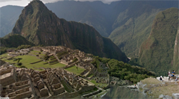
This virtual tour allows viewers to explore Machu Picchu as if they were there. There are virtual tours of several parts of Machu Picchu accessible.
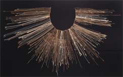
Quipu Recording Device (Artifact)
The quipu was an Incan recording system based on tying knots into string. It allowed government officials to keep records of things like population and crop yields. This page also contains a description of the creation and uses of quipus.
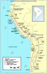
Map of the Inca Empire Road System (Map)
This map shows the extensive network of roads that the Inca created, as well as some of their major cities and modern cities and borders today.
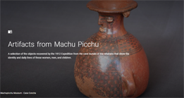
Artifacts from Machu Picchu (Artifacts/Virtual Museum Exhibit)
This virtual museum exhibit allows viewers to examine objects that were found at Machu Picchu and would have been used in everyday life by the Inca people.
Breathing New Life into Inca Farming Practices (Article)
This article from Newsela describes how farmers in the Andes are using ancient Inca farming practices because they are more suited to the climate than many current practices.
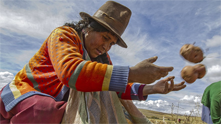
Pedro de Cieza de Léon: Chronicles of the Incas, 1540 (Journal)
A Spanish conquistador, Pedro de Cieza de Léon, describes the Inca government and economy in 1540.
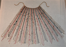
This is another quipu from the Inca empire.
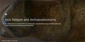
Inca Religion and Archaeoastronomy (Artifact/Virtual Museum)
This virtual exhibit allows viewers to examine objects that would have held special religious significance to the Inca. The objects show the fine craftsmanship of Inca artists in a variety of materials.
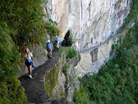
The Inca trail was a route of pilgrimage to Machu Picchu used by the Inca (or Emperor) in the 15th century. It’s part of an extensive Inca system of trails of more than 23,000 kilometres that integrated the Tahuantinsuyo Empire (which means four regions) that covered Colombia, the west of Brazil, Ecuador, Peru and Bolivia. This photograph shows one of the many trails built by the Inca in present-day Peru.
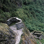
This photograph shows the remnants of buildings along the Inca Trail, one of the many trails built by the Inca.

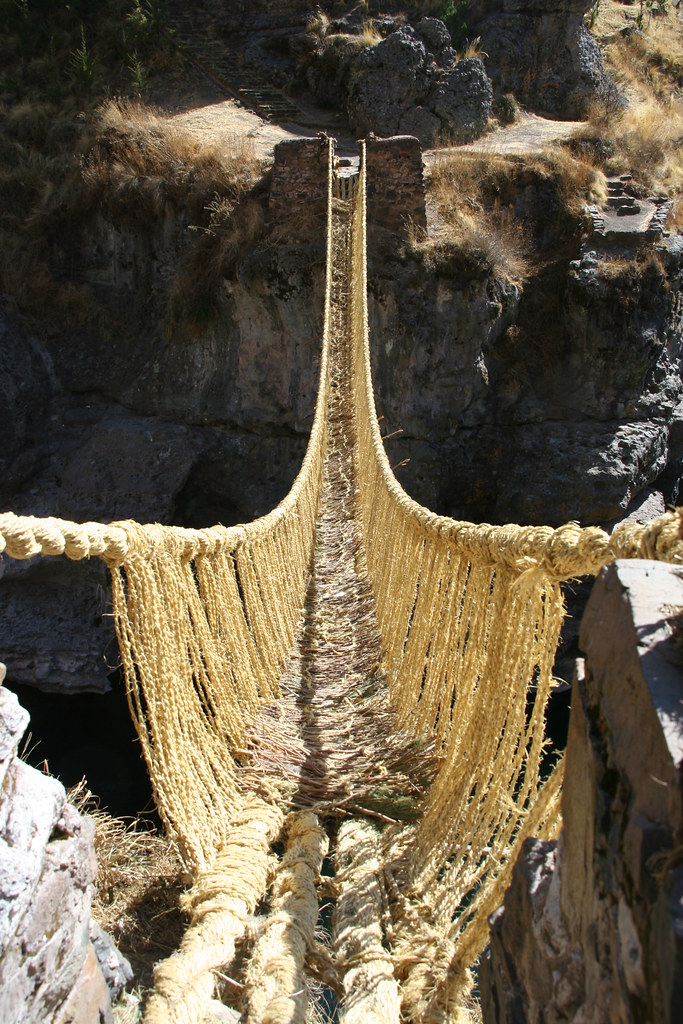
Inca Grass Bridge (Photograph) & The Inca Grass Bridge (Video)
This five minute video, adapted from a NOVA special, shows current day residents of Peru building a rope bridge in the style of the ancient Inca.
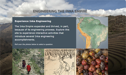
Engineering the Inca Empire (Photographs & Artifacts/Online exhibit)
This online exhibit from the Smithsonian Institution, provides information on how the Inca were able to build a network of roads, grow crops at high altitudes, and solve other engineering problems to build their empire.
Financial information on schools and districts throughout Colorado. Learn more about financial transparency.
Colorado Dept. of Education
201 East Colfax Ave.
Denver, CO 80203
Phone: 303-866-6600
Contact CDE
CDE Hours
Mon to Fri, 8 a.m. to 5 p.m.
See also Licensing Hours
UPDATED
August 2, 2017
Copyright © 1999-2025 Colorado Department of Education.
All rights reserved.
Title IX.
Accessibility.
Disclaimer.
Privacy.

Connect With Us


